Maps Are Arguments
A map looks like a statement of fact and is usually a statement of interest. European maps of the Gold Coast were made to guide ships, to justify claims, to impress patrons and to sell atlases, and each purpose left its mark on what appears and what does not. Read as evidence rather than as illustration, they are among the most revealing sources available for the Dutch presence in West Africa.
The Coast in Extraordinary Detail
The first thing anyone notices is the imbalance. The shoreline is drawn with real precision: every fort, every landing place, every headland, with soundings, anchorages and the distances between posts. Ten or twenty kilometres inland the detail collapses. This is not because Europeans were incurious. It is because the coast was where they were, where their money was made, and where getting the geography wrong would wreck a ship. The interior was somebody else's territory, and they were there on sufferance.
The result is that European cartography of West Africa maps European activity accurately and African polities badly. That imbalance is itself the historical finding: the maps show a maritime commercial presence, not a territorial occupation, and they show it clearly for two hundred years before the situation changed.
The Major Dutch and European Makers
- The Amsterdam publishing houses — Blaeu, Hondius, Janssonius and their successors produced the printed maps of Guinea that circulated across Europe in the seventeenth century. They are beautiful, they were commercial products, and they copied one another freely; an error in one edition can persist for a century.
- Olfert Dapper and John Ogilby — Dapper's 1668 description of Africa and Ogilby's English adaptation of 1670 carried maps and views that shaped the European picture of the coast, although neither compiler had been there.
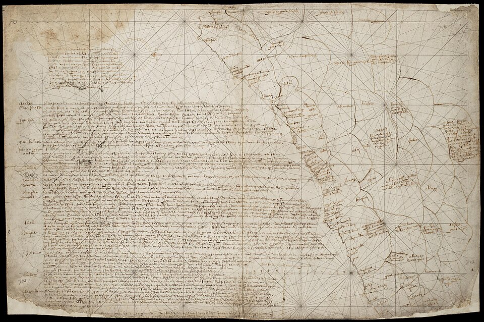
- Manuscript maps from the Company archives — these are the ones that matter most for research. Fort plans, coastal surveys, sketch maps sent home with despatches: unpublished, made for use rather than sale, and correspondingly closer to what their makers actually knew. An anonymous Dutch map of 1629 depicting inland polities is a famous example, later published with commentary by Kwame Daaku and Albert van Dantzig, and it is one of the earliest European attempts to represent the political geography behind the coast.
- Nineteenth-century survey mapping — as colonial administration extended inland, triangulated survey replaced the coastal chart. These maps are accurate in the technical sense and are documents of conquest: they exist because the territory was being brought under administration.
How to Read a Map Critically
- Ask what the map was for. A sailing chart, an atlas plate, a fort plan and a boundary map are different genres with different truth conditions.
- Check whether the maker had been there. Much printed cartography was compiled in Amsterdam from other people's material.
- Treat blank space as information about the mapmaker. An empty interior does not mean an empty landscape; it means the European surveyor had no data and no access. Later maps filled such spaces with decoration, with speculative rivers, or with the names of peoples placed approximately.
- Distrust firm lines inland. Boundaries drawn with confidence in the interior are usually inference or assertion. Asante authority was exercised over people, roads and tribute relations, and it did not map neatly onto a bounded territory of the European kind.
- Track place names. Spellings shift between Dutch, Portuguese, English and Danish usage and back again; identifying a place often means recognising it through several orthographies.
- Compare editions. Where a map was reissued over decades, the changes between states show what new information arrived and what was simply recopied.
Where to Find Them
Manuscript maps relating to the Dutch possessions are held at the Nationaal Archief in The Hague, including in its dedicated collections of foreign maps and drawings, and a growing number are available as digital images. The Atlas of Mutual Heritage brings together maps, plans and views of Company sites from Dutch archives and museums in a single searchable database, and is usually the fastest place to start. Printed atlas maps are widely digitised: the Rijksmuseum, university library map collections in the Netherlands, and the major national libraries all publish high-resolution images of seventeenth- and eighteenth-century Guinea maps that can be downloaded freely. For the colonial survey period, the British national archive and map libraries hold the Gold Coast series.
What Maps Can Tell You That Texts Cannot
Used carefully, maps answer questions that written sources leave vague. They show how close the forts stood to one another and therefore how competitive the trade was. They record the position of villages and landing places that later disappeared. Fort plans show garrison size, storage capacity and defensive priorities in a form that can be measured. And a sequence of maps of the same stretch of coast, read in order, shows European knowledge of West Africa growing, stalling and finally, in the nineteenth century, turning inland — which is the visual record of a change in intent.